Building Pipelines for the Solar Industry
Internship Report
Joaquin Gottlebe

Geographic Information (Geodata)
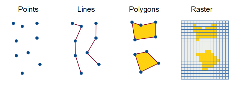
| id | name | category | elevation_m | geometry |
|---|---|---|---|---|
| 1 | Berlin Center | city | 34 | POINT(13.4050 52.5200) |
| 2 | Potsdam Station | transport | 38 | POINT(13.0657 52.3914) |
| 3 | Forest Plot A | sample_site | 72 | POINT(12.9876 52.4123) |
| 4 | Lake View | observation | 29 | POINT(13.1025 52.4568) |
| 5 | Weather Sensor 01 | sensor | 45 | POINT(13.2211 52.3347) |
Definition: [...] Information about locations on or near the surface of the Earth [...]"
michaelminn.net/tutorials/arcgis-pro-terrain/ Liu & Özsu, 2009: Encyclopedia of Database Systems
Basics: Spatial Operations
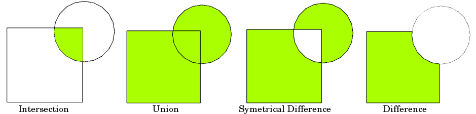
Definition: (Spatial) operations refer to the operations that an end user performs on maps stored in a database.
geopandas.org Liu & Özsu, 2009: Encyclopedia of Database Systems
Basics: Geographic Information Systems (GIS)
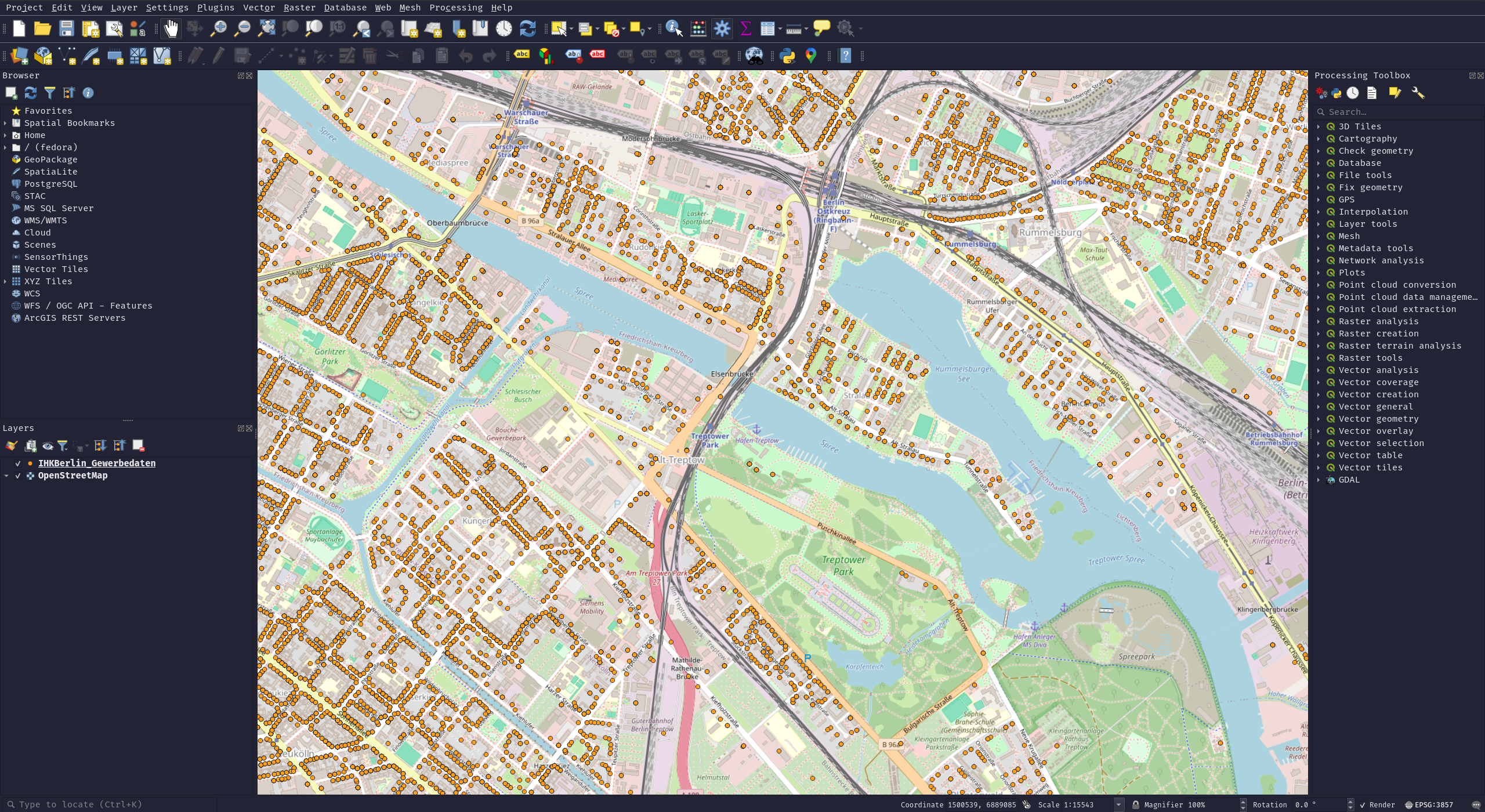
Definition: "[...] is a computer application designed to perform a wide range of operations on geographic information. [...] A GIS includes functions to input, store, visualize, export, and analyze (geographic) information."
©OpenStreetMap contributors Liu & Özsu, 2009: Encyclopedia of Database Systems
Internship Overview
Company: Enerparc AG
Industry domain: Solar industry
Duration: 360 hours over 4 months
Role: GIS Developer
My Background
Bachelor in Geography: Specialised in Remote Sensing and Geographic Information Systems and had 4 years of experience tutoring RS/GIS
Master in Computational Science: Currently pursuing, in my 4th semester
Why Enerparc
First industry experience
How is the dev experience in a non-tech company?
Enerparc Expertise
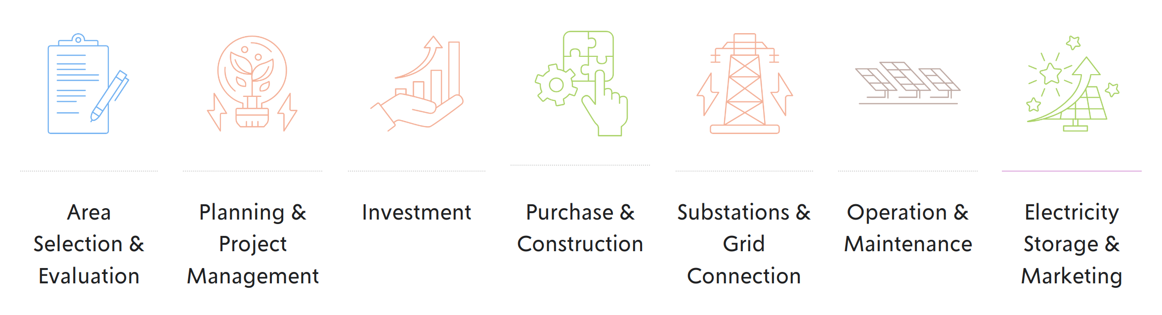
The company is involved in every stage of solar energy projects, acting as both a project developer, operator and service provider for third parties.
ENERPARC AG. enerparc.de
Enerparc in numbers
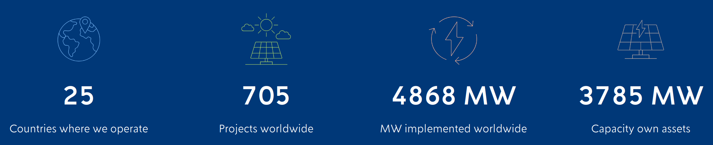
Covers the electricity needs of 1.2 million households
ENERPARC AG. enerparc.de
Enerparc Solar Parcs in Germany
ENERPARC AG. enerparc.de/en/projects#solar-parks-germany
My Team
Department: GIS Development & Administration
Personnel: 1 Team lead, 1 Full time, 2 Working students
Tasks: GIS Plugin development, Geodata engineering, WebGIS administration, Geodatabase administration
Project
Research question: How to handle geodata pipelines?
Needed: Daily updated geodata on energy assets of Germany
Use cases: Monitoring of market activity
Architecture: ETL (extract, transform, load)
ETL Pipeline

own illustration
Extraction

own illustration
Extraction: Marktstammdatenregister

Description: Official registry of all facilities and units in the German energy system
Provider: Bundesnetzagentur
Access Methods: SOAP API (Simple Object Access Protocol) / XML bulk download
marktstammdatenregister.de
Extraction: Marktstammdatenregister
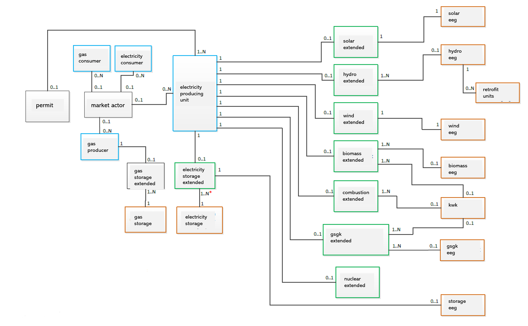
marktstammdatenregister.de
Extraction: Marktstammdatenregister
Development:
- Tried out the SOAP API
- Realised an API is made for small extractions
- Tried out the bulk download with hundreds of XML files
- Realised the XML's are relational to each other and encoded
- Wrote a whole library to handle the XML dump
- Found out there is already an open source library for this (open-mastr)
Extraction: Enerparc Assets
Description: Current photovoltaic systems owned by Enerparc AG
Provider: Enerparc AG Engineering
Access Methods: REST API (Representational State Transfer)
Extraction: Enerparc Assets
Development:
- Asked the engineering department for the list of IDs
- Realised they always change
- Asked the engineering department for access to the DB
- They created a new REST API endpoint for this
- Accessed this endpoint over a simple http request
Extraction: Borders
Description: Country & Municipality Borders
Provider: Enerparc AG GIS
Access Methods: SQL Queries
Database Model: Relational
Extraction: Borders
Development:
- Added the data manually to the repository
- Realised borders can also change
- Accessed them using SQL statements during the processing
Transformation

own illustration
Transformation
Development:
- Started with Python and GeoPandas (GeoDataFrames)
- Unknowingly reinvented SQL in Python
- Realised SQL is way better for stuff like this
- Used a local SQLite DB for processing
- But still needed to do some spatial operations in python
- Realised the destination server has PostGIS (SQL for spatial operations)
- Moved whole pipeline into the database with some absurdly long SQL aka "I replaced my entire stack with PostgreSQL"
- Processing took over a day and crashed the server
- Realised the database server only has 4 GB RAM and a weak CPU
- Moved everything back to Python
- They lived happily ever after
Loading

own illustration
Loading
Development:
- Used GeoPandas built in upload functionality
- Found out open-mastr can load it directly to the PostgreSQL database
- Since I moved everything to the DB anyway, this was fitting
- But then again I moved everything back
Architecture

own illustration
Results: Photovoltaic Systems
Data: Marktstammdatenregister
Results: Battery Storage Systems
Data: Marktstammdatenregister
Results: Wind Turbines
Data: Marktstammdatenregister
Reflections: Building ETL Pipelines
-
"Those who do not understand SQL are condemned to reinvent it, poorly." Adapted from Henry Spencer
-
Check your system specifications before you change architectures.
- There is still a lot to learn ...
Reflections: First Industry Experience
Positive
- Reduced pressure to perform
- Satisfaction of seeing your creation in production
- Obstkorb
Negative
- A lot of meetings
- Slow processes
- Rigid structures
Reflections: Dev Experience in a Non-Tech Company
Positive
- You can learn a lot
- More independence
- More control over your projects
- Access to more important projects
Negative
- More responsibilities
- More task switching
- Less supervision
Next Project
Geo-ETL library for WFS Services
- Amtliches Liegenschaftskatasterinformationssystem (Gemarkungen, Flure, Flurstuecke, Gebaeudedaten, ...)
- Bundesamt fuer Naturschutz (Vogelschutzgebiete, Nationalparke, Naturschutzgebiete,...)
- Biotope
- ...
WFS (Web Feature Service): This standard defines direct fine-grained access to geographic information ogc.org/standards/wfs/
Acknowledgments
Thanks to my team and Enerparc AG.
And thank you for listening.